Warm and Cold Advection Generated by
Short Waves at Mid Levels
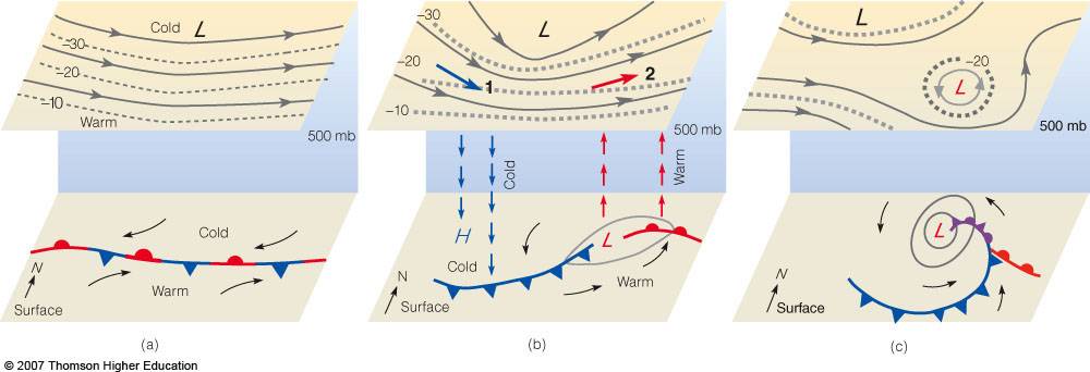
- consider a long wave trough over a
stationary front (a). Then, a short wave moves
into the trough, intensifying the trough (b)
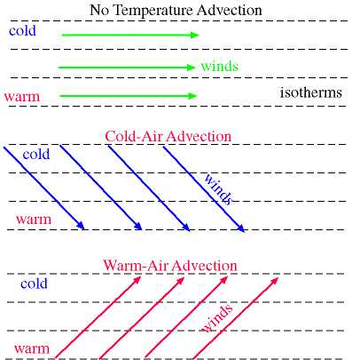
- Notice that initially (a), the
streamlines and isotherms are parallel to each
other - the atmosphere is barotropic
- In (b), the short wave has acted
to cause the streamlines to cross the isotherms
both west and east of the trough. The atmosphere
there is now "baroclinic".
- In the baroclinic region west of
the trough, cold-air advection is occurring
- In the baroclinic region east of
the trough, warm-air advection is occurring
|
- Cold-air advection west of the trough will
produce sinking motion as the cold air descends
to the surface behind the cold front
- Warm-air advection east of the trough will
produce rising motion near the center of the low
as the warm air ascends.
- This sinking and rising of cold and warm air due
to cold and warm air advection is called baroclinic instability
- Baroclinic instability is a necessary ingredient
for the development and intensification of a mid-latitude cyclone.
- check out this
real-world example
- The sinking and rising of warm air produced by
baroclinic instability can also be visualized by
the warm- and cold-conveyor belt model
|