
About the Lyndon Mesonet (click for description)
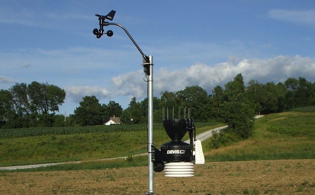
From 2015 to 2017, the Atmospheric Sciences department deployed a mesonet of weather observation sites across the state of Vermont. The stations were given an identifier beginning with LSC and appended with a number, e.g. LSC01, LSC02, etc. As new stations were installed, they receive a consecutive number in the naming scheme. These stations were strategically placed to fill spatial gaps among existing weather station locations. Most mesonet sites use a Wireless Vantage Pro2™ Plus weather station that reports temperature, dew point, relative humidity, barometric pressure, wind speed and direction, and incoming solar radiation data. This information is transmitted to the Citizens Weather Observing Program (i.e. CWOP) and subsequently into the National Oceanic and Atmospheric Administration’s Meteorological Assimilation Data Ingest System (MADIS) and the MesoWest data aggregation and distribution system.


One limitation of the data transmission method used by most Lyndon mesonet sites is that they report the data to CWOP, and subsequently to MesoWest and MADIS, at 15 minute intervals, using WeatherLinkIP™ data loggers. In MesoWest, the Lyndon mesonet sites are incorporated into the broader Vermont Weather Analytics Center (i.e. VTWAC) network.
MADIS and VTWAC data are used to:
- confirm observed weather conditions
- create more accurate weather forecasts by incorporating observed weather conditions into weather models
- verify weather model results
Meteotemplates are from http://meteotemplate.com
The data on these Meteotemplate pages are available every 5 minutes (as opposed to 15 minutes in CWOP and MesoWest):