NVU-Lyndon students in front of a shelf cloud in New Mexico. Pictured from left to right: Catie McNeil, Bobby Saba, Camryn Kruger, and Maddie Degroot
Storm Forecasting and Observation Program Overview
Dr. Preston and four Northern Vermont University-Lyndon Atmospheric Sciences students participated in the SUNY Oswego Storm Forecasting and Observation Program earlier this summer (May 27-June 15). This program is designed for students to apply concepts from the classroom to the forecasting and observation of thunderstorms. The first two weeks were spent in the field, forecasting severe weather and observing storm structure. This involved launching weather balloons to collect data about the environment, as well as using programs like RadarScope and Baron Mobile Threat Net® to examine radar data and track storms. For the last week of the program, students completed a research project related to their storm observations. Some of the research projects this year used GR2Analyst, IDV, SHARPpy, and BUFKIT for analysis.
Select any image below to enlarge it to full-size.
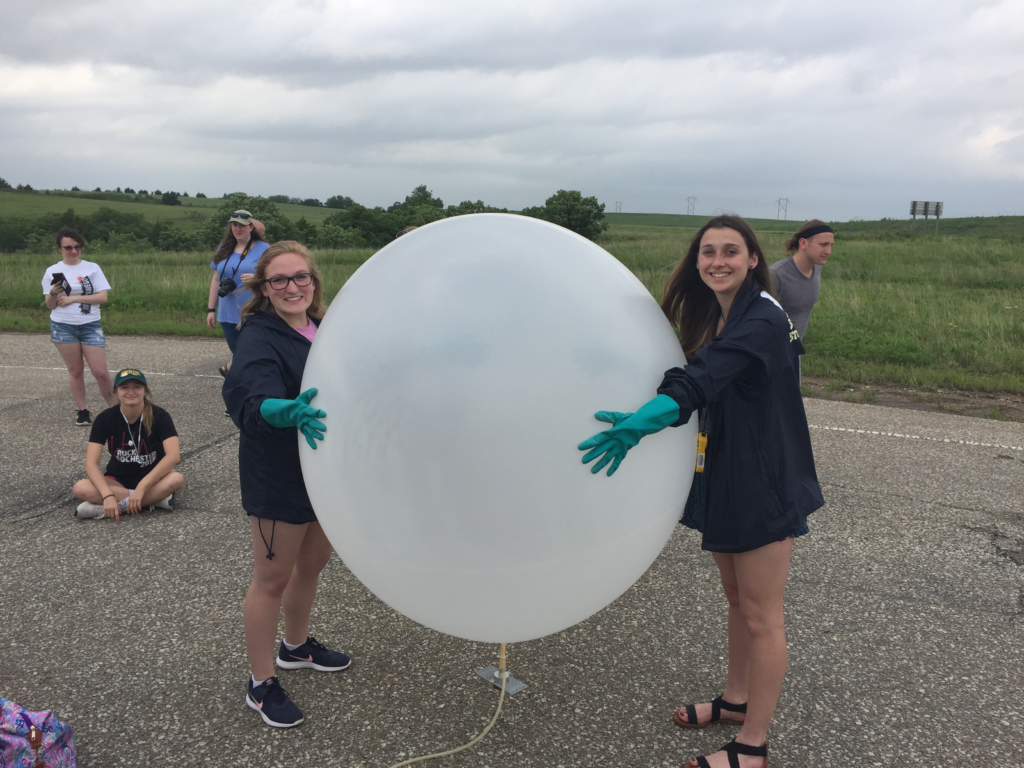
Catie McNeil (right) preparing to launch a weather balloon in northern Kansas. Shortly after, the group chased tornadic supercells in northern Kansas. 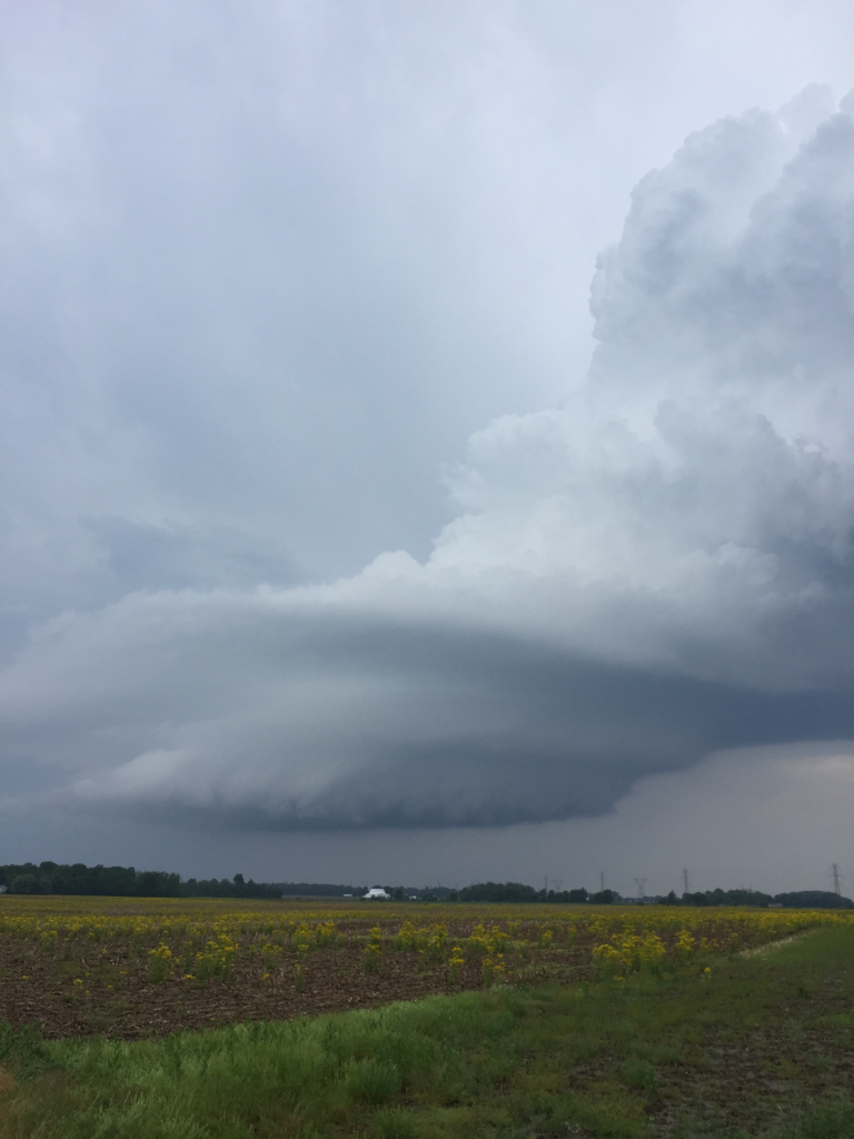
Spiral-shaped, low-precipitation supercell in Indiana on Day 1 of the trip.
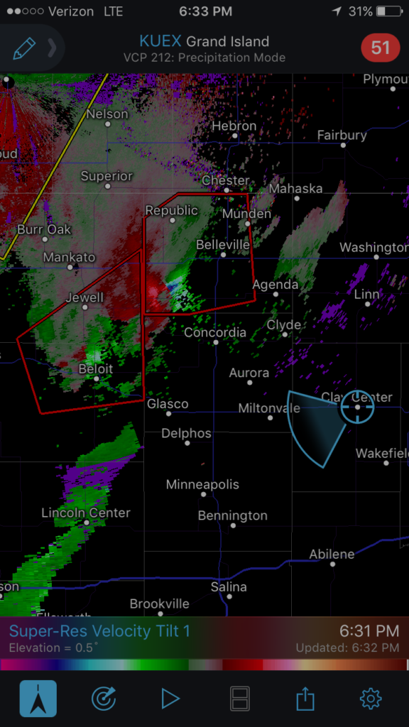
High-resolution radial velocity (0.5-degree tilt) showing strong gate-to-gate shear associated with tornadic supercells in northern Kansas. 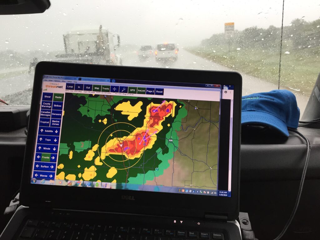
Mobile Threat Net® showing the position of the vans as they punched through a small hail core (0.25-inch) to escape a developing storm to the south. The storm to the north had baseball size hail.
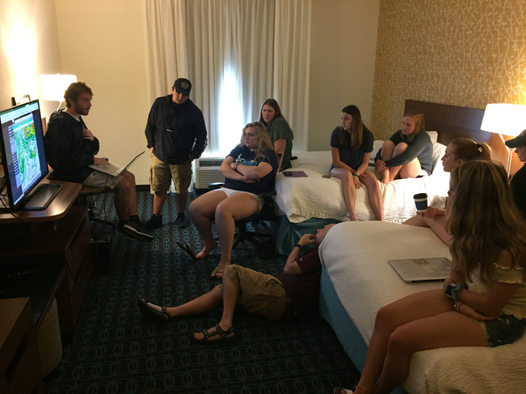
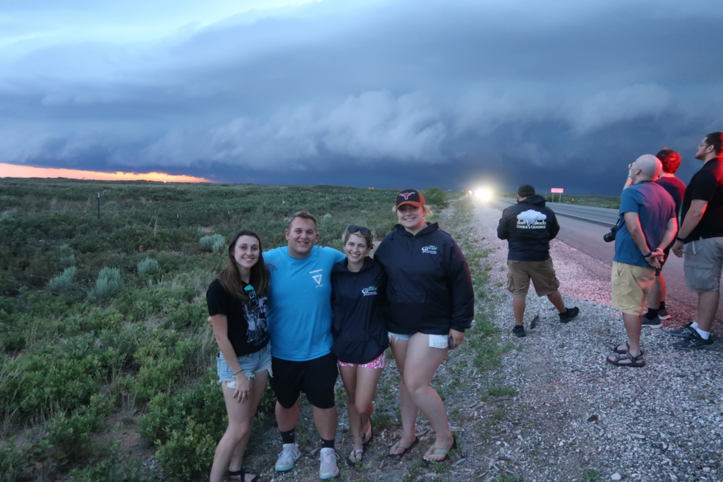
Morning weather briefing in the hotel before the group chased supercells in New Mexico that afternoon.
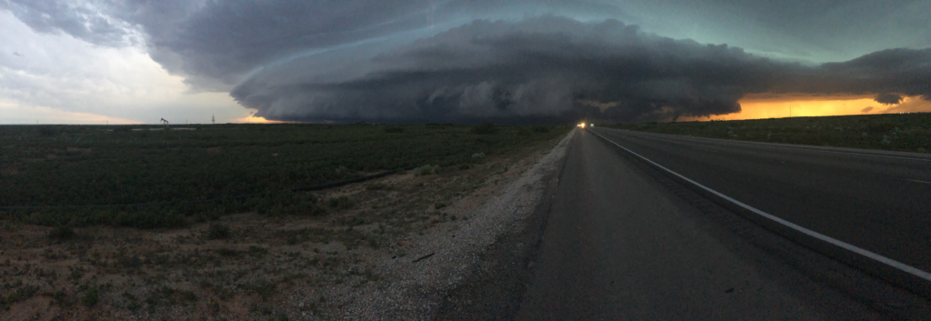
Wall cloud associated with a low precipitation supercell in New Mexico.
Observed Weather
During the 2019 Storm Forecasting and Observation Program, students saw three visible tornadoes (and one rain-wrapped), over a dozen wall clouds, dust devils, 0.25-inch hail, mammatus clouds, cloud iridescence, and incredible lightning activity. Students traveled through 10 different states (see trip log below), including Pennsylvania, Ohio, Indiana, Illinois, Missouri, Kansas, Oklahoma, Texas, New Mexico, and Colorado.
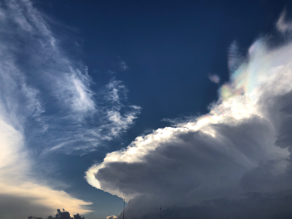
Colorful iridescence associated with the anvil of a supercell in New Mexico. 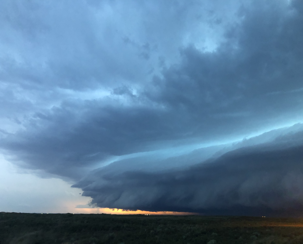
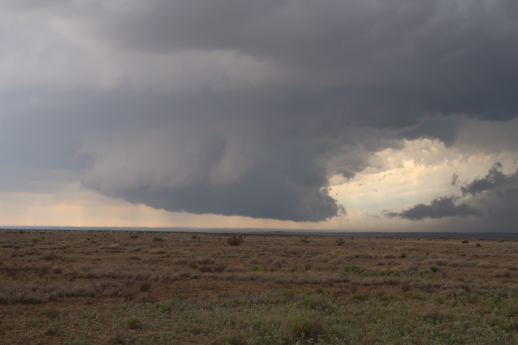
Shelf cloud moving through Hobbs, New Mexico as the sun was setting.
Shelf cloud moving through Hobbs, New Mexico as the sun was setting. It produced large hail and strong winds. The hail core created bright green colors that lit up the sky.
“Down” Days
During the “down” days, students got to visit the Big Well Museum in Greensburg, KS, as well as the Twister Museum in Wakita, OK. They also got to tour the National Weather Center in Norman, OK, which houses the Storm Prediction Center (SPC). Bill Bunting, Chief of Forecast Operations at the SPC, talked about the Storm Prediction Center right outside of the SPC’s forecast room.
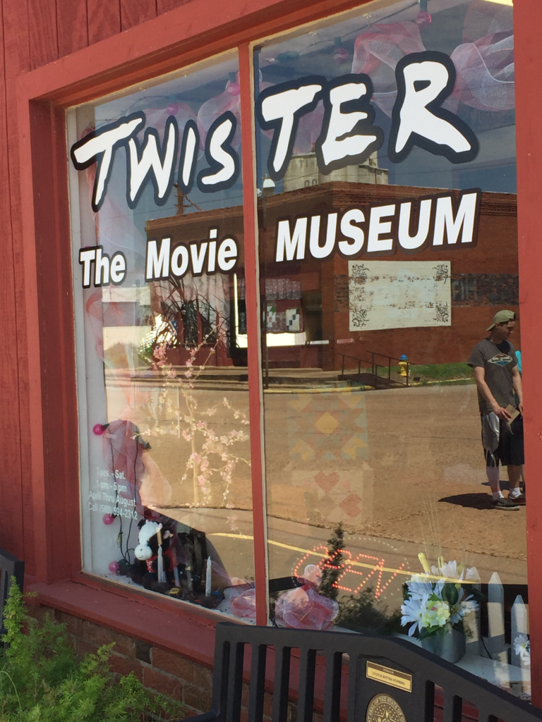
Visiting the Twister Museum in Wakita, OK. 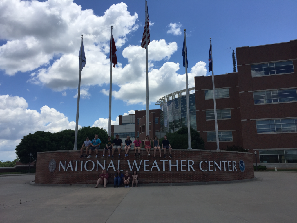
Students in front of the National Weather Center in Norman, OK.
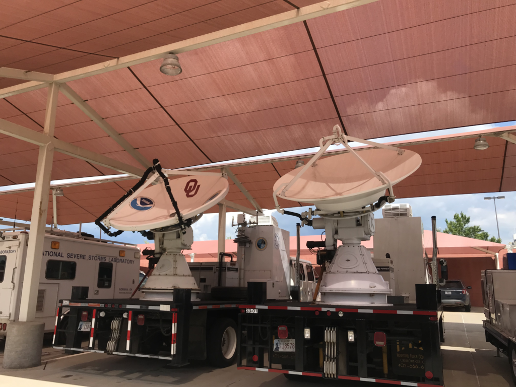
Mobile research radars outside the National Weather Center in Norman, OK 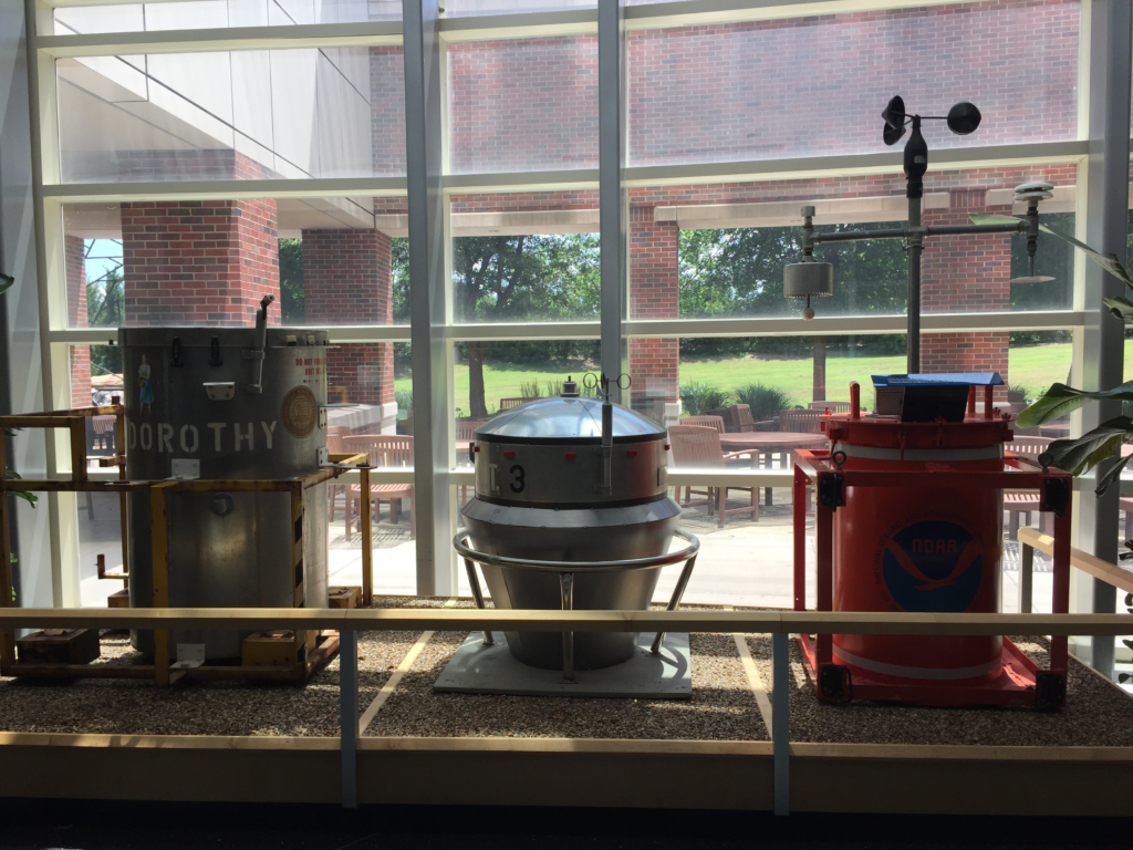
(Left) DOROTHY and (middle) D.O.T. 3 movie props from Twister. (Right) TOtable Tornado Observatory (TOTO) – the real-world, scientific instrument that DOROTHY was based on in the movie. All three instruments can be seen on the first floor of the National Weather Center in Norman, OK. 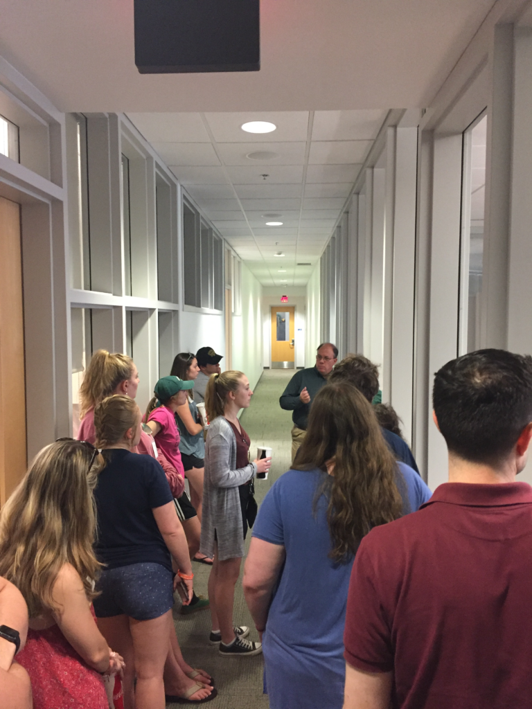
Listening to Bill Bunting, Chief of Forecast Operations at the Storm Prediction Center, talk about the Storm Prediction Center right outside the forecast room.
Daily Logistics
Overall, 13 students participated in the Storm Forecasting and Observation program. This required two separate vans with ham radio communication (like in the movie Twister). On a typical “chase” day, the forecast team would lead a weather briefing around 8:00 am. The vans would then drive 5-6 hours (on average) to the target area. This would get them to their destination by 3:00 pm, which provided enough time to launch a weather balloon before the main period of thunderstorm development at 5:00 pm. Then, the students would observe the severe storm(s) for the next several hours before losing daylight. After sunset, faculty and students would decide where to stay that night to put them in the best position to chase again the next day. With this in mind, it usually meant driving late into the night.
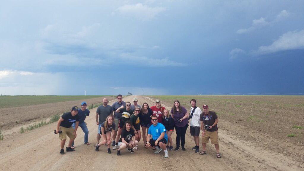
The entire group in front of their first tornado! This was one of two landspout tornadoes they observed in Kanorado, KS.
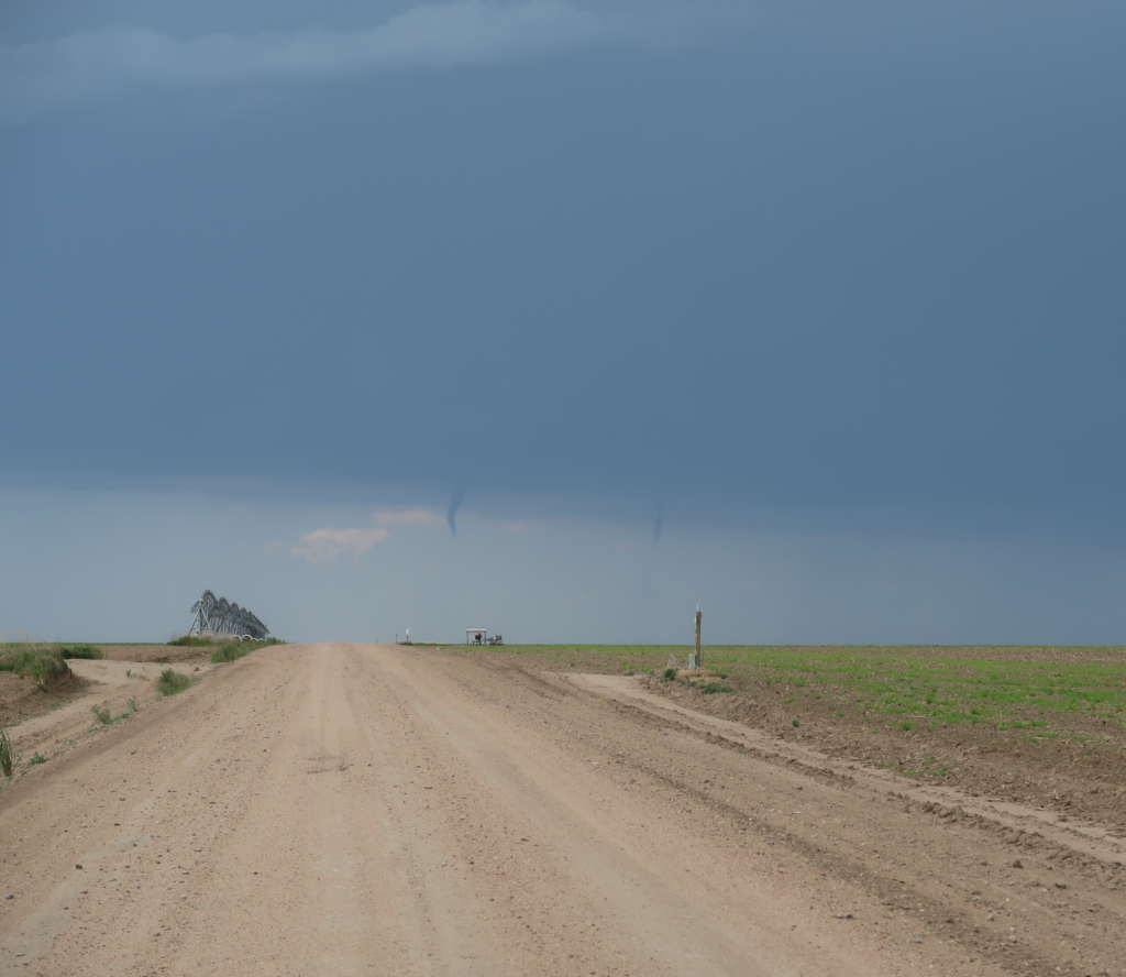
Two condensation funnels occurring simultaneously in Kanorado, KS. The funnel to the right was dissipating as the funnel to the left developed. 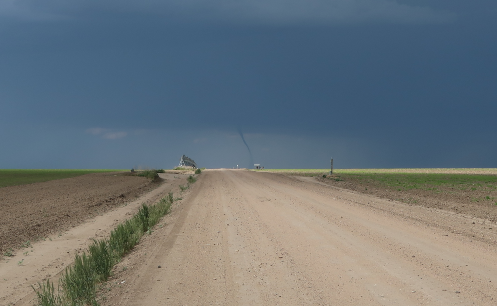
Second landspout tornado in Kanorado, KS picking up debris near the surface.
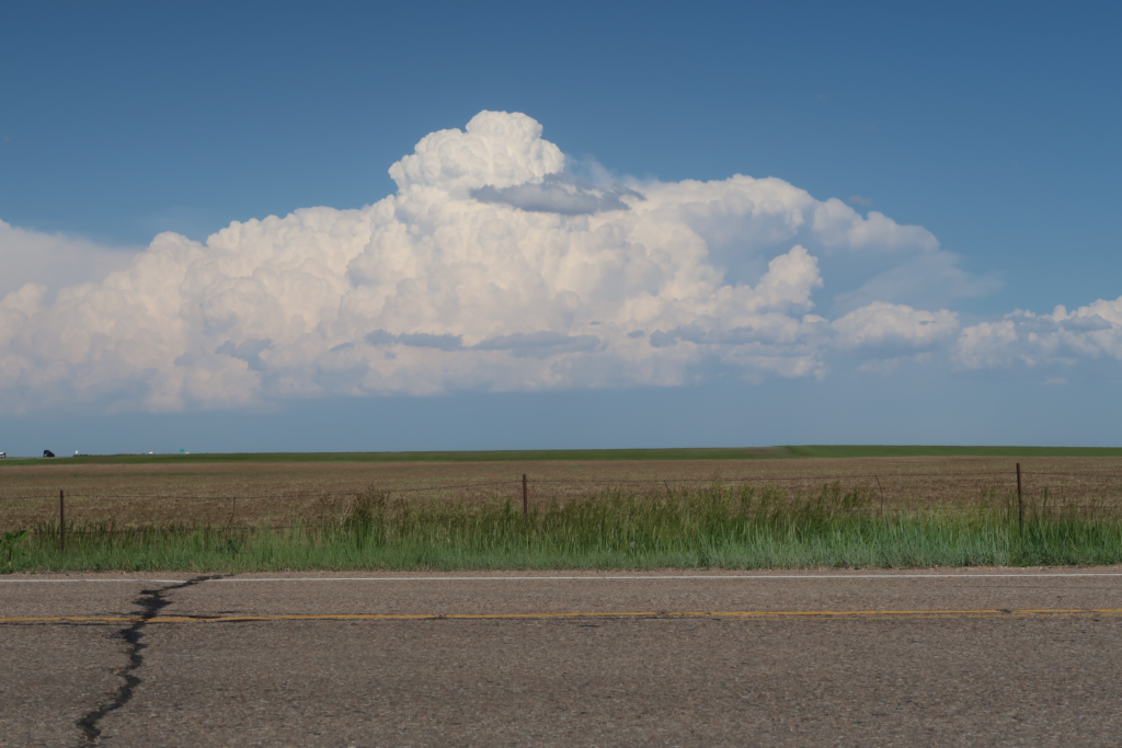
Textbook example of a growing cumulus congestus in Colorado.
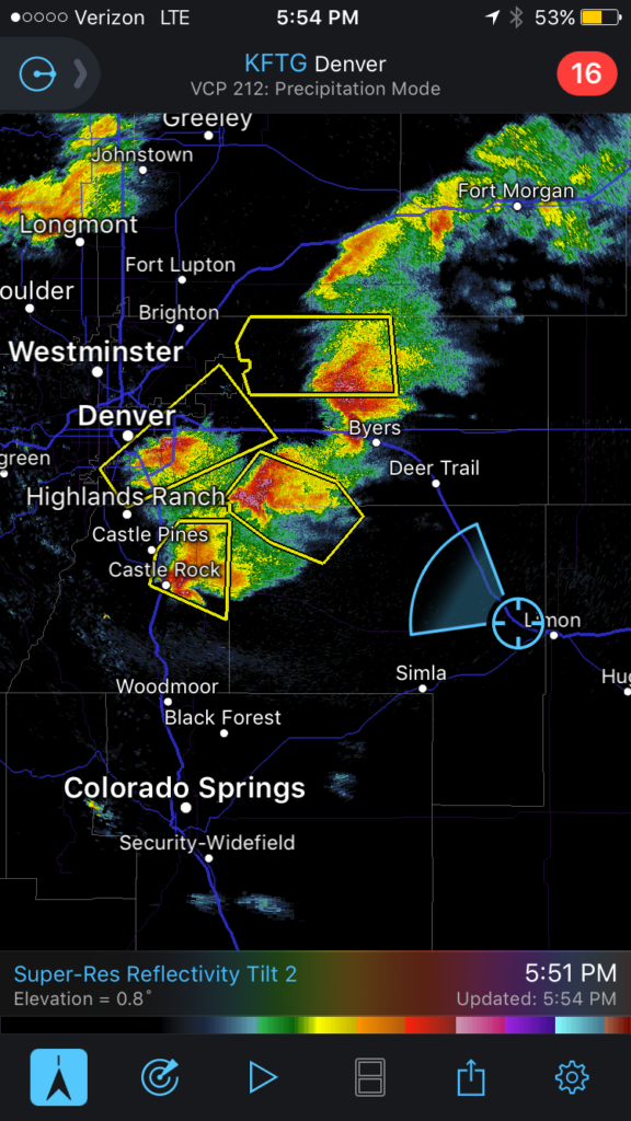
High-resolution reflectivity (0.8-degree tilt) showing well-defined hook echoes associated with three supercells near Denver, CO.
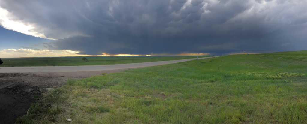
Visual depiction of the three supercells and their wall clouds near Denver, CO. Well-defined mammatus clouds can be seen near the top of the photo.
Trip Log Summary
| 5/27 | Indiana | observed multiple wall clouds from low-precipitation supercells on the first travel day of the Storm Forecasting and Observation Program |
| 5/28 | Kansas | launched a weather balloon; chased tornadic supercells near Nebraska |
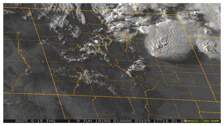
| 5/29 | Northeast Texas | observed a well-defined wall cloud at 20Z; too dangerous to chase tornado near Fort Worth, TX; observed incredible lightning activity |
| 5/30 | Southwest Texas | launched weather balloon at 19Z; chased in the southern tip of Texas (near Big Bend National Park). Had to stop chasing due to the poor road network and in order to avoid hail damage to vehicles. |
| 5/31 | West Texas | launched weather balloon at 14Z; chased a cell rotating anticyclonically and saw a few wall clouds with it. Great visual of hail core with “greenish” tint; observed incredible lightning activity |
| 6/1 | Texas Panhandle | observed several dust devels, followed by a rain-wrapped cell near Dumas with rotation and multiple wall clouds; squall line developed with distinctive shelf cloud; observed straight-line winds and pea-sized hail from the inside of a gas station |
| 6/2 | New Mexico | target cell had large hail core and good rotation for several hours; all of a sudden, two additional cells popped up behind vans; caught in 0.25-inch hail (pea-sized); one of the storms produced beautiful iridescence around the anvils |
| 6/3 | Texas Panhandle | down day; dinner at The Big Texan Steak Ranch |
| 6/4 | Kansas | down day; models overproduced convection, therefore decided not to chase and instead visited the Big Well Museum in Greensburg, KS to learn about the EF5 tornado that devastated the area in May 2007 |
| 6/5 | Oklahoma | down day; visited the Twister Museum and saw the Wakita water tower featured in the Twister movie |
| 6/6 | Oklahoma | down day; saw tornado damage (e.g. torn off signs, roofs, and damage to cars) from EF3 tornado that recently devasted the El Reno area |
| 6/7 | Oklahoma | down day; toured the University of Oklahoma campus, and visited the National Weather Center |
| 6/8 | Colorado | This was the most exciting day of the Storm Forecasting and Observation trip! The group observed two landspout tornadoes in Kanorado, KS at 20Z. Each lasted 5-10 minutes and occurred one after the other. Two condensation funnels were both visible for a short period as one dissipated and a new one formed. Following this, the group observed three supercells with well-defined hook echoes near Denver. These storms were associated with breathtaking mammatus clouds. At this point, the third tornado of the day briefly formed (occurring for about 10 seconds) in the southern-most supercell. Afterwards, some of the students spotted a brief rain-wrapped tornado in the middle supercell. |
| 6/9-6/10 | two travel days back to SUNY Oswego campus | |
| 6/11-6/15 | work on research projects |
Questions & Answers About the Storm Forecasting and Observation Program
What was the most enjoyable part of the trip?
This whole trip was an unbelievable experience, but if I had to pick what I enjoyed the most it would clearly have to be the storms. Before coming out, I had never seen anything compared to what we saw in the plains. Being able to see an entire supercell and admire its structure and watch as it tries to produce a tornado is something special that I don’t think I’ll ever experience again.
Bobby Saba – sophomore, Broadcast Concentration
Why did you choose to storm chase this summer?
I chose to chase this summer because severe weather has been a dream of mine since I was five years old. I remember sitting through a particularly bad thunderstorm and hearing the rain approach my porch. It was torrential rain with severe lightning and booming thunder. Being able to finally chase this dream has been one of the most gratifying experiences I’ve ever had and I am so grateful that I was able to do this. Between the people I’ve met, the memories I’ve made, and the weather I’ve seen, this has been one of the most exhilarating things I’ve ever been able to do.
Catie McNeil – sophomore, Broadcast Concentration
What have you learned on this trip?
I now know how to analyze data to figure out where severe weather is likely to occur. This is very important to know as an aspiring meteorologist so I will be able to share my knowledge with the public. I have seen a lot of clouds in textbooks and pictures, but seeing mammatus clouds and wall clouds in person are so much different; it is amazing. Although I want to broadcast the weather, I love learning about severe weather. I have only completed one year of college so I am glad that I decided to do this program because there are quite a few people here who really know what they are doing and are doing a great job explaining things to me.
Camryn Kruger – sophomore, Broadcast Concentration
Why did you choose to storm chase this summer?
It is something that I’ve always wanted to do. I remember one of the small thunderstorms with my dad in Maine just so I could hear thunder. I grew up watching Tornado Hunters and I was absolutely obsessed. Twister is also my favorite movie so storm chasing just felt like something I needed to do.
Maddie Degroot – junior, National Weather Service/Military & Private Industry Concentrations
Student Research
Bobby Saba, Canton, TX Storms
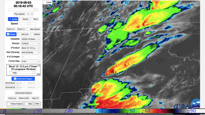
Bobby analyzed two storms that moved through Canton, TX on 29 May 2019. He was looking to find common radar signatures between storms producing multiple tornadoes.
Camryn Kruger, Cloud Iridescence
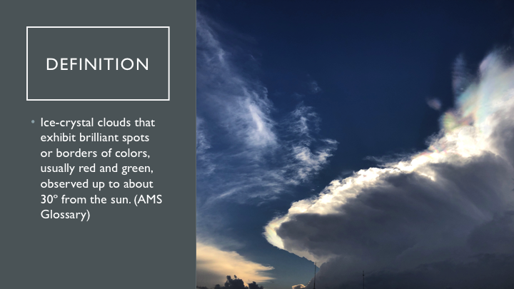
Camryn examined the colorful iridescence that occurred around the anvils of supercells in New Mexico on 2 June 2019. Specifically, she looked for signatures of iridescence in radar and satellite fields.
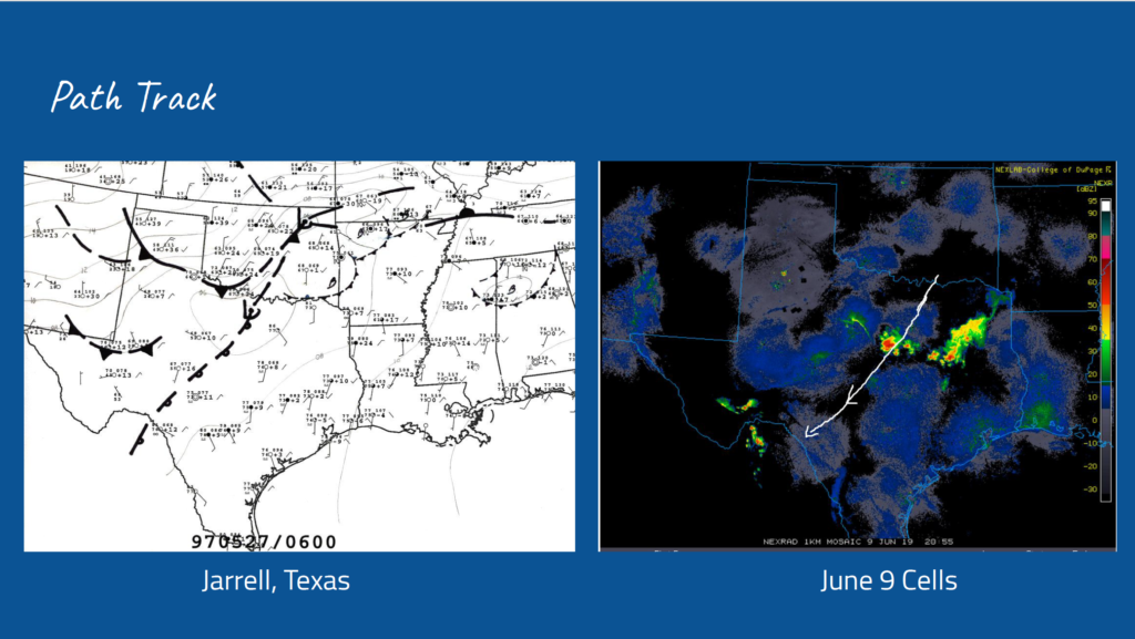
Catie McNeil, High Instability/Low Shear Tornadoes
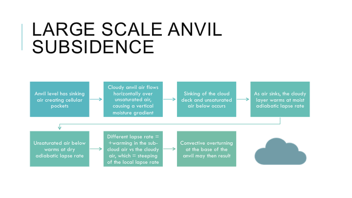
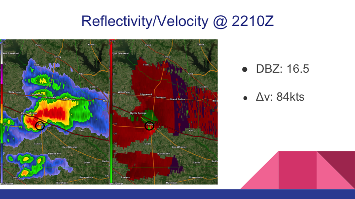
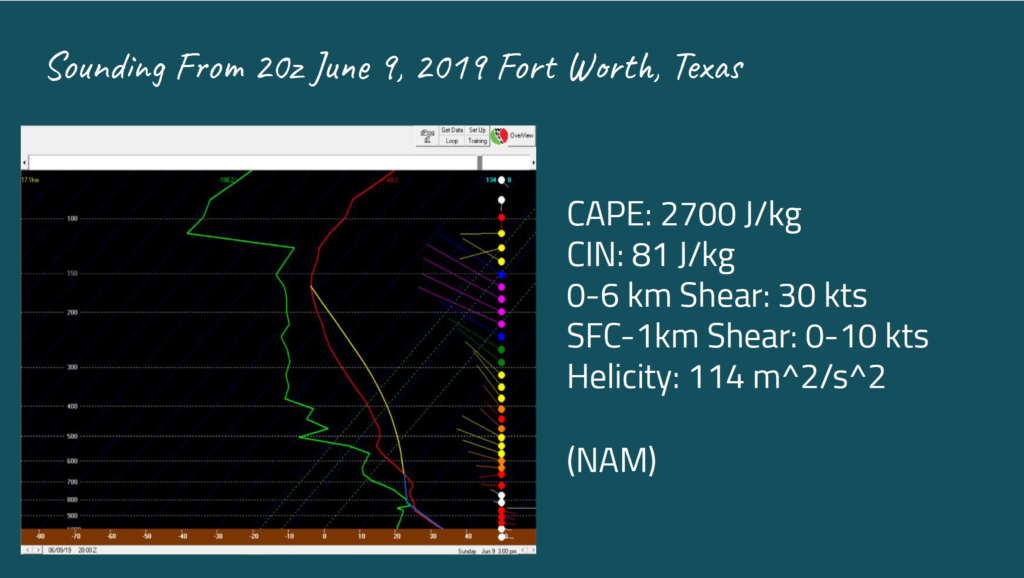
Catie studied common characteristics that produced tornadoes in high instability (i.e. Convective Available Potential Energy, CAPE), low vertical wind shear environments. Specifically, she compared the environment for the Jarrell, TX tornado (CAPE greater than 8000 J/kg) on 27 May 1997 to the 9 June 2019 tornado near Fort Worth, TX.
Maddie Degroot, Mysterious Mammatus
Maddie examined the stunning mammatus clouds associated with the three supercells near Denver, CO on 8 June 2019. This study showed the difficulty in identifying mammatus clouds using the standard WSR-88D S-Band radar.