Types of Satellite Data
Satellites collect two primary types of meteorological imagery:
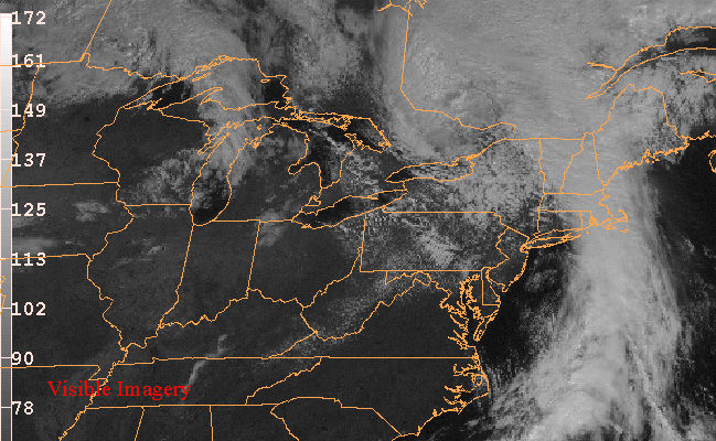
Visible
basically a picture of the clouds - much like taking a picture with your camera
Infrared - tells you the temperature of what the satellite is sensing, whether its the ground or the tops of clouds
very useful for determining the height of the cloud (low, middle, high)
Infrared imagery....
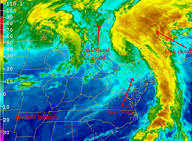
Here is a comparison of visible, IR, and water vapor imagery